Help Centre

Coupon Override
Please Call
For drivers under the age of 25, additional fees and/or restrictions may apply.
For information and assistance in completing your reservation, please call:
1-855-863-0357Sorry
We're unable to find your location.

Room %{=roomIndex} Age of child %{=index}
Europe and Mediterranean: Scandinavian Solar Eclipse with Greenland & Scotland Cruise

Holland America Line
Marvel at the magic of the solar eclipse from a spectacular vantage point. Other highlights include: Iceland's crystal fjords, Greenland's stark beauty and an Edinburgh overnight.


Executive Member Benefit
Executive Members receive an annual 2% Reward, up to $1,250, on qualified Costco Travel purchases

Digital Costco Shop Card
Member Exclusive: Digital Costco Shop Card with every Holland America Line sailing†
Onboard the Nieuw Statendam
ms Nieuw Statendam
Costco Member Reviews
Year Built: 2017
Honoring Holland America Line's past while keeping its eyes on the future, Nieuw Statendam is the sixth ship in Holland America Line’s history to bear the name Statendam and features several of the innovative venues that were introduced on her sister ship, the Koningsdam.
Onboard Activities 
Activities & Services (included in cruise)
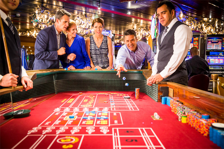
Casino
- Bars/Lounges
- Casino
- Concierge Desk
- Culinary Arts Center
- Elevators
- Fitness Center
- Organized Age-Specific Activities
- Pool - Indoor/Covered
- Pool - Outdoor
- Safe Deposit Boxes
- Sports Facilities
- Teen Programs
- Whirlpool/Jacuzzi
Activities & Services (available for an extra fee)
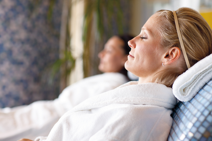
Greenhouse Spa
- Dry Cleaning/Laundry Service
- Duty-Free Shops/Boutiques
- Full-Service Spa
- Infirmary/Medical Center
- Spa Services/Massage
Costco Travel makes every effort to verify the accuracy of all information provided. Additional fees for amenities or services may be charged by the cruise line. Amenities or services may be discontinued or revised by the cruise line without notice. Staterooms designated as wheelchair-accessible do not necessarily meet CDA requirements. Costco Travel is not responsible for inaccuracies or provider modifications.
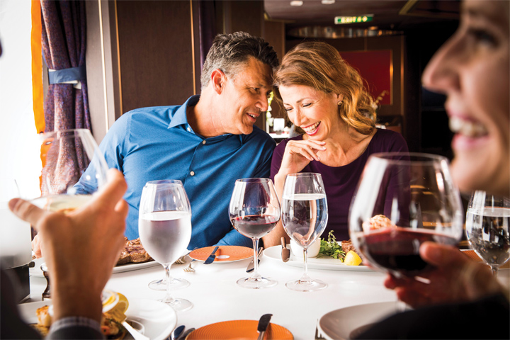
Dining
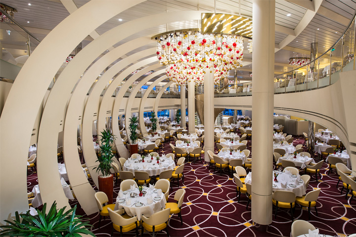
The Dining Room
Main Dining
The Dining Room: For breakfast, lunch or an unforgettable five-course dinner, the elegant main Dining Room is your destination for sophisticated dining, with menu selections from classic favorites to vegetarian options, to dishes inspired by the regions you’ll visit. Menus by Holland America Line's Culinary Council® of world-renowned chefs.
Pinnacle Grill
Specialty Dining
Pinnacle Grill: Enjoy dishes inspired by America’s Pacific Northwest, such as king salmon from Alaska and choice, responsibly raised beef from Washington State’s Double R Ranch. Complement your meal with a selection of boutique wines from the Pacific Northwest and other celebrated vineyards from around the world. This restaurant is available for an additional cost.
Canaletto: This authentic Italian restaurant offers a menu that celebrates spartire (Italian for "sharing"). Try Braised Chicken Cacciatore "al Forno," Branzino ai Ferri or a classic Italian pasta: spaghetti pomodoro or garlic shrimp-infused ravioli, perhaps. Buon appetito! This restaurant is available for an additional cost.
Tamarind: Tamarind delights diners with exotic menus evoking the culinary traditions of Southeast Asia, China and Japan. Recently noted by Condé Nast Traveler for its “cuisine that rivals the top restaurants on land,” Tamarind is located on the uppermost deck, providing stunning panoramic views. Lunch includes tantalizing items such as steamed dim sum and spicy crab. Exotic dinner menus created by Master Chef Rudi Sodamin feature dishes honoring the elements of water, wood, fire and earth. This restaurant is available for an additional cost.
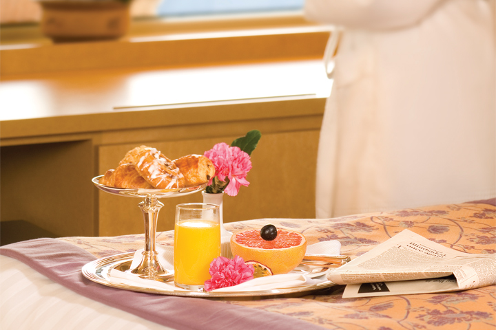
Room Service
Casual Dining
Lido Market: Lido Market provides a fresh, new approach to casual dining for breakfast, lunch or dinner, with a panoramic view of the sea. A modern marketplace with different themed stations, the Lido offers a curated selection of delicious options to grab on the go or to have quickly made to order.
Dive-In: Dive in to a grilled burger on brioche or a Nathan’s Famous gourmet hot dog. For alfresco dining by the pool, Dive-In has it all, including lighter fare like the grilled chicken breast sandwich and vegetarian-friendly portabella mushroom stack.
New York Pizza: Crisp Italian salads and personal pan pizzas made with a thin crust and a savory sauce are served up poolside.
Explorations Café: A comfortable, coffeehouse environment offering espresso drinks and pastries. This restaurant is available for an additional cost.
Grand Dutch Café: Inspired by blue and white Delftware, the Grand Dutch Café is the place to enjoy a fine pale lager or favorite coffee beverage with a traditional Dutch snack. This restaurant is available for an additional cost.
Room Service: Complimentary 24-hour dining in the comfort of your stateroom.
Times, costs and other specifics are outside the control of Costco Travel. All information is at the sole discretion of the cruise line and is subject to change without notice. Dining time and table size preferences are submitted to the cruise line on a first-come, first-served request basis and are confirmed aboard ship. Questions, concerns and/or special needs regarding dining arrangements must be addressed with the maitre d' hotel aboard ship. Every effort is made to accommodate travelers' preferences; however, Costco Travel cannot guarantee dining arrangements. In specialty restaurants, space is limited and reservations are recommended. A cover charge and dress code may apply.
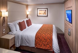
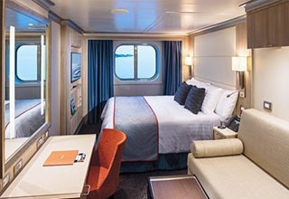
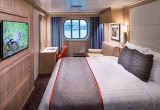
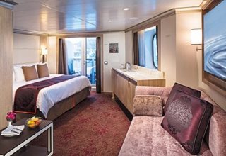
Staterooms
- Large or Standard Interior Stateroom (Category: I)

Category: I
Big on comfort, our 143–225 sq.ft Inside staterooms offer exceptional value with two beds that convert to one queen-size bed — our signature Mariner's Dream™ bed with plush euro-top mattress — premium massage showerheads and a host of amenities.
- Large Interior Spa Stateroom (Category: IQ)
Category: IQ
Big on comfort, our 143–225 sq.ft Inside staterooms offer exceptional value with two beds that convert to one queen-size bed — our signature Mariner's Dream™ bed with plush euro-top mattress — premium massage showerheads and a host of amenities.
- Standard Interior Stateroom (Category: L)
Category: L
Big on comfort, our 143–225 sq.ft Inside staterooms offer exceptional value with two beds that convert to one queen-size bed — our signature Mariner's Dream™ bed with plush euro-top mattress — premium massage showerheads and a host of amenities.
- Standard Interior Stateroom (Category: K)
Category: K
Big on comfort, our 143–225 sq.ft Inside staterooms offer exceptional value with two beds that convert to one queen-size bed — our signature Mariner's Dream™ bed with plush euro-top mattress — premium massage showerheads and a host of amenities.
- Standard Interior Stateroom (Category: J)
Category: J
Big on comfort, our 143–225 sq.ft Inside staterooms offer exceptional value with two beds that convert to one queen-size bed — our signature Mariner's Dream™ bed with plush euro-top mattress — premium massage showerheads and a host of amenities.
- Standard Interior Stateroom (Category: N)
Category: N
Big on comfort, our 143–225 sq.ft Inside staterooms offer exceptional value with two beds that convert to one queen-size bed — our signature Mariner's Dream™ bed with plush euro-top mattress — premium massage showerheads and a host of amenities.
- Large Oceanview Stateroom (Category: F)

Category: F
With a view of the ocean through a window or porthole, these expansive staterooms include a sitting area, two beds that convert to one queen-size bed — our signature Mariner's Dream™ bed with plush euro-top mattress — premium massage showerheads, and a host of amenities.
- Family Oceanview Stateroom (Category: FB)
Category: FB
With a view of the ocean through a window or porthole, these expansive staterooms include a sitting area, two beds that convert to one queen-size bed — our signature Mariner's Dream™ bed with plush euro-top mattress — premium massage showerheads, and a host of amenities.
- Family Oceanview Stateroom (Category: FA)
Category: FA
With a view of the ocean through a window or porthole, these expansive staterooms include a sitting area, two beds that convert to one queen-size bed — our signature Mariner's Dream™ bed with plush euro-top mattress — premium massage showerheads, and a host of amenities.
- Large Oceanview Stateroom (Category: E)
Category: E
With a view of the ocean through a window or porthole, these expansive staterooms include a sitting area, two beds that convert to one queen-size bed — our signature Mariner's Dream™ bed with plush euro-top mattress — premium massage showerheads, and a host of amenities.
- Single Oceanview Stateroom (Category: OO)
Category: OO
With a view of the ocean through a window or porthole, these expansive staterooms include a sitting area, two beds that convert to one queen-size bed — our signature Mariner's Dream™ bed with plush euro-top mattress — premium massage showerheads, and a host of amenities.
- Large Oceanview Stateroom (Category: D)
Category: D
With a view of the ocean through a window or porthole, these expansive staterooms include a sitting area, two beds that convert to one queen-size bed — our signature Mariner's Dream™ bed with plush euro-top mattress — premium massage showerheads, and a host of amenities.
- Large Oceanview Stateroom (Category: C)
Category: C
With a view of the ocean through a window or porthole, these expansive staterooms include a sitting area, two beds that convert to one queen-size bed — our signature Mariner's Dream™ bed with plush euro-top mattress — premium massage showerheads, and a host of amenities.
- Large Oceanview Spa Stateroom (Category: CQ)
Category: CQ
With a view of the ocean through a window or porthole, these expansive staterooms include a sitting area, two beds that convert to one queen-size bed — our signature Mariner's Dream™ bed with plush euro-top mattress — premium massage showerheads, and a host of amenities.
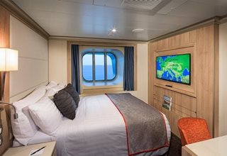
- Verandah Stateroom (partially obstructed view) (Category: VH)
Category: VH
Floor-to-ceiling glass doors lead to your balcony, infusing these coveted 228–405 sq.ft staterooms with natural light. Enjoy a private verandah overlooking the ocean, a spacious sitting area for unwinding, and our signature Mariner's Dream™ bed that can convert from one queen to two beds.
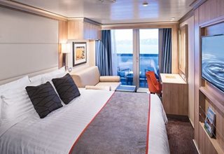
- Verandah Stateroom (Category: V)
Category: V
Floor-to-ceiling glass doors lead to your balcony, infusing these coveted 228–405 sq.ft staterooms with natural light. Enjoy a private verandah overlooking the ocean, a spacious sitting area for unwinding, and our signature Mariner's Dream™ bed that can convert from one queen to two beds.
- Verandah Stateroom (Category: VB)
Category: VB
Floor-to-ceiling glass doors lead to your balcony, infusing these coveted 228–405 sq.ft staterooms with natural light. Enjoy a private verandah overlooking the ocean, a spacious sitting area for unwinding, and our signature Mariner's Dream™ bed that can convert from one queen to two beds.
- Verandah Stateroom (Category: VC)
Category: VC
Floor-to-ceiling glass doors lead to your balcony, infusing these coveted 228–405 sq.ft staterooms with natural light. Enjoy a private verandah overlooking the ocean, a spacious sitting area for unwinding, and our signature Mariner's Dream™ bed that can convert from one queen to two beds.
- Verandah Stateroom (Category: VS)
Category: VS
Floor-to-ceiling glass doors lead to your balcony, infusing these coveted 228–405 sq.ft staterooms with natural light. Enjoy a private verandah overlooking the ocean, a spacious sitting area for unwinding, and our signature Mariner's Dream™ bed that can convert from one queen to two beds.
- Verandah Stateroom (Category: VA)
Category: VA
Floor-to-ceiling glass doors lead to your balcony, infusing these coveted 228–405 sq.ft staterooms with natural light. Enjoy a private verandah overlooking the ocean, a spacious sitting area for unwinding, and our signature Mariner's Dream™ bed that can convert from one queen to two beds.
- Verandah Spa Stateroom (Category: VQ)
Category: VQ
Floor-to-ceiling glass doors lead to your balcony, infusing these coveted 228–405 sq.ft staterooms with natural light. Enjoy a private verandah overlooking the ocean, a spacious sitting area for unwinding, and our signature Mariner's Dream™ bed that can convert from one queen to two beds.
- Verandah Stateroom (Category: VF)
Category: VF
Floor-to-ceiling glass doors lead to your balcony, infusing these coveted 228–405 sq.ft staterooms with natural light. Enjoy a private verandah overlooking the ocean, a spacious sitting area for unwinding, and our signature Mariner's Dream™ bed that can convert from one queen to two beds.
- Verandah Stateroom (Category: VD)
Category: VD
Floor-to-ceiling glass doors lead to your balcony, infusing these coveted 228–405 sq.ft staterooms with natural light. Enjoy a private verandah overlooking the ocean, a spacious sitting area for unwinding, and our signature Mariner's Dream™ bed that can convert from one queen to two beds.
- Verandah Stateroom (Category: VE)
Category: VE
Floor-to-ceiling glass doors lead to your balcony, infusing these coveted 228–405 sq.ft staterooms with natural light. Enjoy a private verandah overlooking the ocean, a spacious sitting area for unwinding, and our signature Mariner's Dream™ bed that can convert from one queen to two beds.
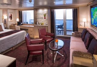
- Vista Suite with Verandah (Category: AS)
Category: AS
Graced with a private verandah, floor-to-ceiling glass doors, and comfortable sitting areas, our 260–356 sq.ft Vista Suites are filled with natural light. They include two beds that convert to one queen-size bed — our signature Mariner's Dream™ bed with plush euro-top mattress.- Refrigerator
- Set of binoculars
- Pinnacle Suite with Verandah (Category: PS)
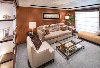
Category: PS
Our premier 1,290 sq.ft Pinnacle Suite features floor-to-ceiling glass doors, a large private verandahs, living, dining, and dressing rooms, and lush sleeping accommodations with luxurious Duxiana® king beds. These elegant suites sleep up to four guests and include a Whirlpool tub and an independent, full-size shower stall, dual-sink vanities, and guest toilets.- 1,290 sq.ft
- Exclusive access to the Neptune Lounge
- Personal concierge
- Priority check-in
- Complimentary laundry service, pressing, and dry cleaning
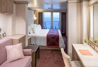
- Signature Suite with Verandah (Category: SY)
Category: SY
These elegant 393–400 sq.ft suites feature a sitting area with floor-to-ceiling windows overlooking a private verandah. Signature Suites accommodate up to four guests with two beds that convert to a queen- or king-size bed — our signature Mariner's Dream™ bed, and a Murphy, Pullman, or sofa bed, depending on configuration.- 393–400 sq.ft
- Refrigerator
- Set of binoculars
- Vista Suite with Verandah (Category: A)
Category: A
Graced with a private verandah, floor-to-ceiling glass doors, and comfortable sitting areas, our 260–356 sq.ft Vista Suites are filled with natural light. They include two beds that convert to one queen-size bed — our signature Mariner's Dream™ bed with plush euro-top mattress.- Refrigerator
- Set of binoculars
- Neptune Suite with Verandah (Category: SC)
Category: SC
Featuring floor-to-ceiling glass doors, spacious private verandah, expansive sitting areas, and comfortable sleeping accommodations with Mariner's Dream™ beds, our 465–502 sq.ft suite sleeps up to four guests and boasts a deep soaking tub and an independent, full-size shower stall, dual-sink vanities, premium bathrobes, pillow menus, fresh flowers, and binoculars.- 465–502 sq.ft
- Exclusive use of Neptune Lounge
- Personal concierge
- Priority check-in
- Complimentary laundry service, pressing, and dry cleaning
- Signature Suite with Verandah (Category: SS)
Category: SS
These elegant 393–400 sq.ft suites feature a sitting area with floor-to-ceiling windows overlooking a private verandah. Signature Suites accommodate up to four guests with two beds that convert to a queen- or king-size bed — our signature Mariner's Dream™ bed, and a Murphy, Pullman, or sofa bed, depending on configuration.- 393–400 sq.ft
- Refrigerator
- Set of binoculars
- Vista Suite with Verandah (Category: BC)
Category: BC
Graced with a private verandah, floor-to-ceiling glass doors, and comfortable sitting areas, our 260–356 sq.ft Vista Suites are filled with natural light. They include two beds that convert to one queen-size bed — our signature Mariner's Dream™ bed with plush euro-top mattress.- Refrigerator
- Set of binoculars
- Neptune Suite with Verandah (Category: SA)
Category: SA
Featuring floor-to-ceiling glass doors, spacious private verandah, expansive sitting areas, and comfortable sleeping accommodations with Mariner's Dream™ beds, our 465–502 sq.ft suite sleeps up to four guests and boasts a deep soaking tub and an independent, full-size shower stall, dual-sink vanities, premium bathrobes, pillow menus, fresh flowers, and binoculars.- 465–502 sq.ft
- Exclusive use of Neptune Lounge
- Personal concierge
- Priority check-in
- Complimentary laundry service, pressing, and dry cleaning
- Neptune Spa Suite with Verandah (Category: SQ)
Category: SQ
Featuring floor-to-ceiling glass doors, spacious private verandah, expansive sitting areas, and comfortable sleeping accommodations with Mariner's Dream™ beds, our 465–502 sq.ft suite sleeps up to four guests and boasts a deep soaking tub and an independent, full-size shower stall, dual-sink vanities, premium bathrobes, pillow menus, fresh flowers, and binoculars.- 465–502 sq.ft
- Exclusive use of Neptune Lounge
- Personal concierge
- Priority check-in
- Complimentary laundry service, pressing, and dry cleaning
- Vista Suite with Verandah (Category: B)
Category: B
Graced with a private verandah, floor-to-ceiling glass doors, and comfortable sitting areas, our 260–356 sq.ft Vista Suites are filled with natural light. They include two beds that convert to one queen-size bed — our signature Mariner's Dream™ bed with plush euro-top mattress.- Refrigerator
- Set of binoculars
- Neptune Suite with Verandah (Category: SB)
Category: SB
Featuring floor-to-ceiling glass doors, spacious private verandah, expansive sitting areas, and comfortable sleeping accommodations with Mariner's Dream™ beds, our 465–502 sq.ft suite sleeps up to four guests and boasts a deep soaking tub and an independent, full-size shower stall, dual-sink vanities, premium bathrobes, pillow menus, fresh flowers, and binoculars.- 465–502 sq.ft
- Exclusive use of Neptune Lounge
- Personal concierge
- Priority check-in
- Complimentary laundry service, pressing, and dry cleaning
Deck Plan
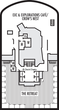
| Symbol | Description |
|---|---|
 | Shower only |
 | Connecting rooms |
 | Uncovered verandah |
 | Staterooms have solid steel verandah railings instead of clear-view plexiglass railings |
 | Triple (2 lower beds, 1 sofa bed) |
 | Double (2 lower beds convertible to 1 king-size bed, no Murphy bed) |
 | Fully accessible, roll-in shower only |
 | Floor-to-ceiling windows |
 | Triple (2 lower beds, 1 upper) |
 | Ambulatory accessible, shower only with small step, step into bathroom, standard interior and exterior door size |
 | Quad (2 lower beds, 1 sofa bed, 1 upper) |
 | Partially obstructed view |
Ship Facts
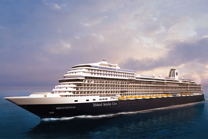
- Ship Name: Nieuw Statendam
- Ship Name: ms Nieuw Statendam
- Year Built: 2017
- Year Entered Present Fleet: 2018
- Ship Class: Pinnacle
- Maximum Capacity: 2,666
- Number of Passenger Decks: 13
- Number of Crew: 1,036
- Officers' Nationality: International
- Tonnage (GRT): 99,500
- Country of Registry: Netherlands
- Crew/Hotel Staff Nationality: International
Costco Travel makes every effort to verify the accuracy of all information provided. Additional fees for amenities or services may be charged by the hotel, resort or cruise line. Amenities or services may be discontinued or revised by the provider without notice. Hotels, resorts, ships or accommodations designated as wheelchair-accessible do not necessarily meet CDA requirements. Costco Travel is not responsible for inaccuracies or provider modifications.
Costco Member Reviews
Available Dates and Prices
Available Dates and Prices not available at this time for this particular sailing. Please click here to enter Destination and Departure Month to see all available sailings.
Terms & Conditions
*Price shown is per person based on double occupancy and is valid for select stateroom categories only. Click on the Terms & Conditions link below for details.
†One Digital Costco Shop Card per room/stateroom, per stay. The exact amount of the Digital Costco Shop Card will be calculated during the booking process. The Digital Costco Shop Card promotion is nontransferable and may not be combined with any other promotion. A Digital Costco Shop Card will arrive by email approximately 10 days after the start of your cruise. Click on the Terms & Conditions link below for additional information
Ship's registry: The Netherlands
Package ID: HALSTAEUR20260725
Digital Costco Shop Card
Book this cruise with Costco Travel and receive a Digital Costco Shop Card. The Digital Costco Shop Card is a convenient payment option in our warehouses and on Costco.ca.